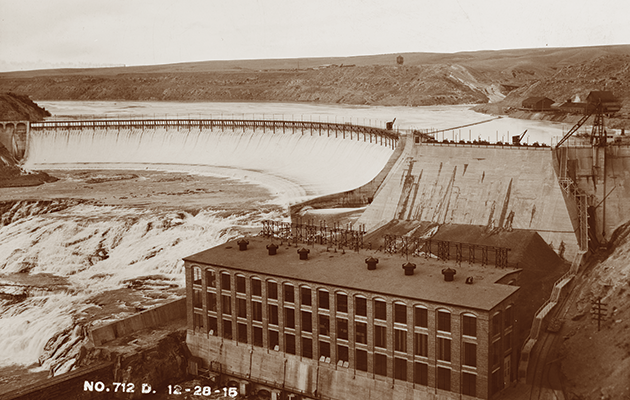
About HAER Documentation
The Historic American Engineering Record (HAER) was established in 1969 as one of the Heritage Documentation Programs administered by the National Park Service (NPS) to record the engineering and industrial heritage of the United States. HAER was created through agreements between the NPS, the Library of Congress, and several engineering societies.
HAER documents a variety of engineering and industrial sites, structures and objects. Transportation infrastructure, bridges, mines, industrial buildings/machinery and public utilities are all types of engineering and industrial heritage that have been recorded under this program. The goal of the HAER program is to record the engineering heritage that is subject to being lost due to a variety of factors. These may include technological advancements creating obsolescence, changing regulations surrounding health/environmental/public safety, and development issues. The NPS, through their Heritage Documentation Program, issues the guidelines for HAER documentation and its dissemination.
As part of the FERC licenses for the eleven hydroelectric facilities that NorthWestern Energy own and operate, HAER documentation is conducted when a project or upgrade is determined to have an adverse effect on a facility’s engineering heritage. After the HAER documentation is completed for a particular project or upgrade, NorthWestern Energy submits the documentation to the NPS for review and acceptance. Once accepted, the HAER program coordinates with the Library of Congress to store the document and disseminate it to the public on their website.
This web page is to help provide access for the public to the HAER documentation conducted at the NorthWestern Energy hydroelectric facilities. Each link below connects to the applicable HAER document available on the Library of Congress website.
Hydroelectric Facilities:
Holter
- Holter Hydroelectric Facility, End of Holter Dam Road, Wolf Creek, Lewis and Clark County, MT
- Holter Hydroelectric Facility, House No. 1, End of Holter Dam Road, Wolf Creek, Lewis and Clark County, MT
- Holter Hydroelectric Facility, House No. 2, End of Holter Dam Road, Wolf Creek, Lewis and Clark County, MT
- Holter Hydroelectric Facility, House No. 4, End of Holter Dam Road, Wolf Creek, Lewis and Clark County, MT
- Holter Hydroelectric Facility, House No. 7, End of Holter Dam Road, Wolf Creek, Lewis and Clark County, MT
- Holter Hydroelectric Facility, House No. 8, End of Holter Dam Road, Wolf Creek, Lewis and Clark County, MT
- Holter Hydroelectric Facility, Mechanic's Garage, End of Holter Dam Road, Wolf Creek, Lewis and Clark County, MT
- Holter Hydroelectric Facility, Dam & Power House, End of Holter Dam Road, Wolf Creek, Lewis and Clark County, MT
- Holter Hydroelectric Facility, Three-Car Garage, End of Holter Dam Road, Wolf Creek, Lewis and Clark County, MT
- Holter Hydroelectric Facility, Four-Car Garage, End of Holter Dam Road, Wolf Creek, Lewis and Clark County, MT
Mystic Lake
- Mystic Lake Hydroelectric Facility, Hoist House, On west slope of West Rosebud Creek, 1 3/4 miles northeast of Mystic Lake Dam, Fishtail, Stillwater County, MT
- Mystic Lake Hydroelectric Facility, Powerhouse, Along West Rosebud Creek, 1 3/4 miles northeast of Mystic Lake Dam, Fishtail, Stillwater County, MT
- Mystic Lake Hydroelectric Facility, Electric Transmission A Line, Along West Rosebud Creek, Fishtail, Stillwater County, MT
Rainbow
- Rainbow Hydroelectric Facility, On north bank of Missouri River 2 miles Northeast of Great Falls, & end of Rainbow Dam Road, Great Falls, Cascade County, MT
- Rainbow Hydroelectric Facility, Foreman's House, On north bank of Missouri River 2 miles Northeast of Great Falls, & end of Rainbow Dam Road, Great Falls, Cascade County, MT
- Rainbow Hydroelectric Facility, Two Stall Garage, On north bank of Missouri River 2 miles Northeast of Great Falls, & end of Rainbow Dam Road, Great Falls, Cascade County, MT
- Rainbow Hydroelectric Facility, Three Stall Garage, On north bank of Missouri River 2 miles Northeast of Great Falls, & end of Rainbow Dam Road, Great Falls, Cascade County, MT
- Rainbow Hydroelectric Facility, Ten Stall Garage, On north bank of Missouri River 2 miles Northeast of Great Falls, & end of Rainbow Dam Road, Great Falls, Cascade County, MT
- Rainbow Hydroelectric Facility, House No. 16, On north bank of Missouri River 2 miles Northeast of Great Falls, & end of Rainbow Dam Road, Great Falls, Cascade County, MT
- Rainbow Hydroelectric Facility, Tool House, On north bank of Missouri River 2 miles Northeast of Great Falls, & end of Rainbow Dam Road, Great Falls, Cascade County, MT
- Rainbow Hydroelectric Facility, Clubhouse, On north bank of Missouri River 2 miles Northeast of Great Falls, & end of Rainbow Dam Road, Great Falls, Cascade County, MT
- Rainbow Hydroelectric Facility, Arbor, On north bank of Missouri River 2 miles Northeast of Great Falls, & end of Rainbow Dam Road, Great Falls, Cascade County, MT
- Rainbow Hydroelectric Facility, Fountain, On north bank of Missouri River 2 miles Northeast of Great Falls, & end of Rainbow Dam Road, Great Falls, Cascade County, MT
- Rainbow Hydroelectric Facility, Swimming Pool, On north bank of Missouri River 2 miles Northeast of Great Falls, & end of Rainbow Dam Road, Great Falls, Cascade County, MT
- Rainbow Hydroelectric Facility, Stone Culvert, On Swimming Pool Road, about 600 feet west-northwest of Powerhouse, Great Falls, Cascade County, MT
- Rainbow Hydroelectric Facility, Plank Bridge, On Swimming Pool Road, about 575 feet west of Powerhouse, Great Falls, Cascade County, MT
- Rainbow Hydroelectric Facility, Terraced Gardens, About 850 feet southwest of Powerhouse, Great Falls, Cascade County, MT
- Rainbow Hydroelectric Facility, Powder Magazine, About 475 feet northeast of Powerhouse, Great Falls, Cascade County, MT
Ryan
- Ryan Hydroelectric Facility, Ryan-to-Rainbow 100 kV Transmission Line, West bank of Missouri River, northeast of Great Falls, Great Falls, Cascade County, MT
- Ryan Hydroelectric Facility, Powerhouse, On Missouri River, northeast of Great Falls, Great Falls, Cascade County, MT
- Ryan Hydroelectric Facility, Water Tank, About 140 feet north of Clubhouse, Great Falls, Cascade County, MT
Thompson Falls
- Thompson Falls Hydroelectric Project, Main Channel Dam, Clark Fork River, Thompson Falls, Sanders County, MT
- Thompson Falls Hydroelectric Project, Warming Hut, On east slope of Main Island, about 35 feet south-southwest of Main Channel Dam, Thompson Falls, Sanders County, MT
- Thompson Falls Hydroelectric Project, Power Foreman's Bungalow, On island between Forebay Channel & ClarkFord River, Thompson Falls, Sanders County, MT
- Thompson Falls Hydroelectric Project, Chicken House, On island between Forebay Channel & ClarkFord River, Thompson Falls, Sanders County, MT
- Thompson Falls Hydroelectric Project, Garage, On road to powerhouse, Thompson Falls, Sanders County, MT